Landscape dynamics and floristic characteristics of the classified forest of Pouniakélé (Northwest of Côte d’Ivoire)

Abstract
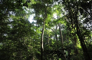
In the face of human encroachment on forest areas, classified forests and other reserves and national parks are the last vestiges of the Ivorian forest. This study aims to make an inventory of plant diversity in the classified forest of Pouniakélé in northern Côte d'Ivoire. A diachronic analysis of Landsat ETM and ETM+ satellite images was used to assess changes in land use over the period 2002 - 2016. Surface and roving inventory methods were used to assess floristic parameters. The results show a tendency for anthropogenic formations to increase at the expense of natural formations. Thus, all the wooded formations have regressed from 72.4% in 2002 to 56.3% in 2016. On the other hand, the cultivated areas have experienced an increase in their surface (13.6% in 2002 to 25.1% in 2016). Concerning the floristic study, a total of 316 plant species, divided into 211 genera and 62 families, were inventoried in the classified forest. Among these flora, 30 species presented a particular status, proof of the conservation value of this plant formation. However, many anthropic activities threaten the integrity of this classified forest.
Keywords: Land use, Satellite images, Floristic parameters, Conservation value, Côte d’Ivoire